
The Library of Congress contains pretty much every document published in the USA, but increasingly they have been making many of those documents available online via very high-quality scans. When the weather is not conducive to outdoor adventures, I sometimes search around to find things of interest that I can work, improve, and, yes, make available as prints. I’ve written before about restoring the old painting of the B&O train on the Buckhorn Wall in West Virginia, but I’ve also enhanced some maps of my local area as well.
I found the drawing of the street layout of Morgantown to be in pretty good condition to start with, and I just needed to brighten and sharpen it a bit to add some more contrast to get a very reasonable print:
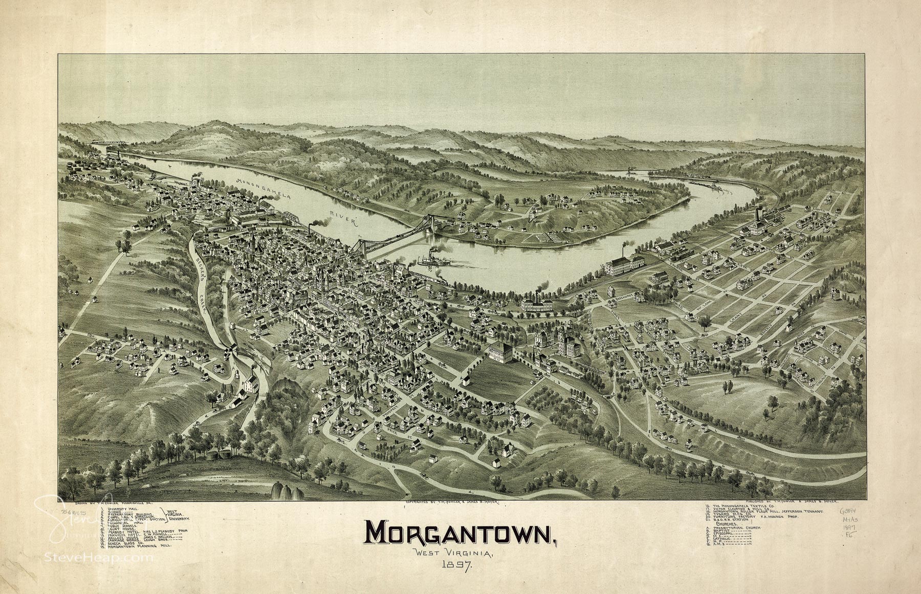
I’m pretty sure that when this drawing was first commissioned, it would have been printed on white paper and this has faded over time and so I also created a whiter version that I think would be closer to the original:
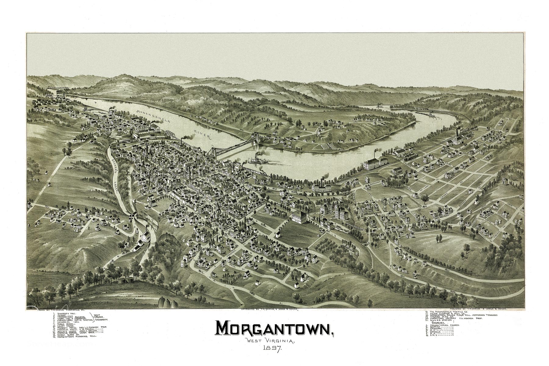
I also created a clean version with more of a beige edging as that might match your decor a little better. All of them are in my portfolio!
The detail that the artist created on these drawings is spectacular. Here is a section of the map showing the fine details he achieved.
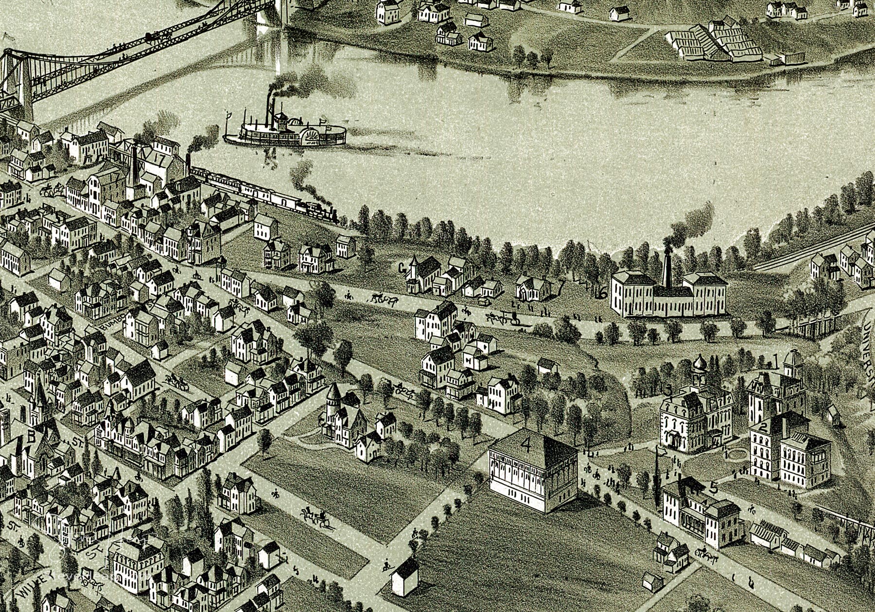
For the technically minded, this image is 9500 pixels wide, which would easily print at 60 inches wide or more without showing any pixelation.
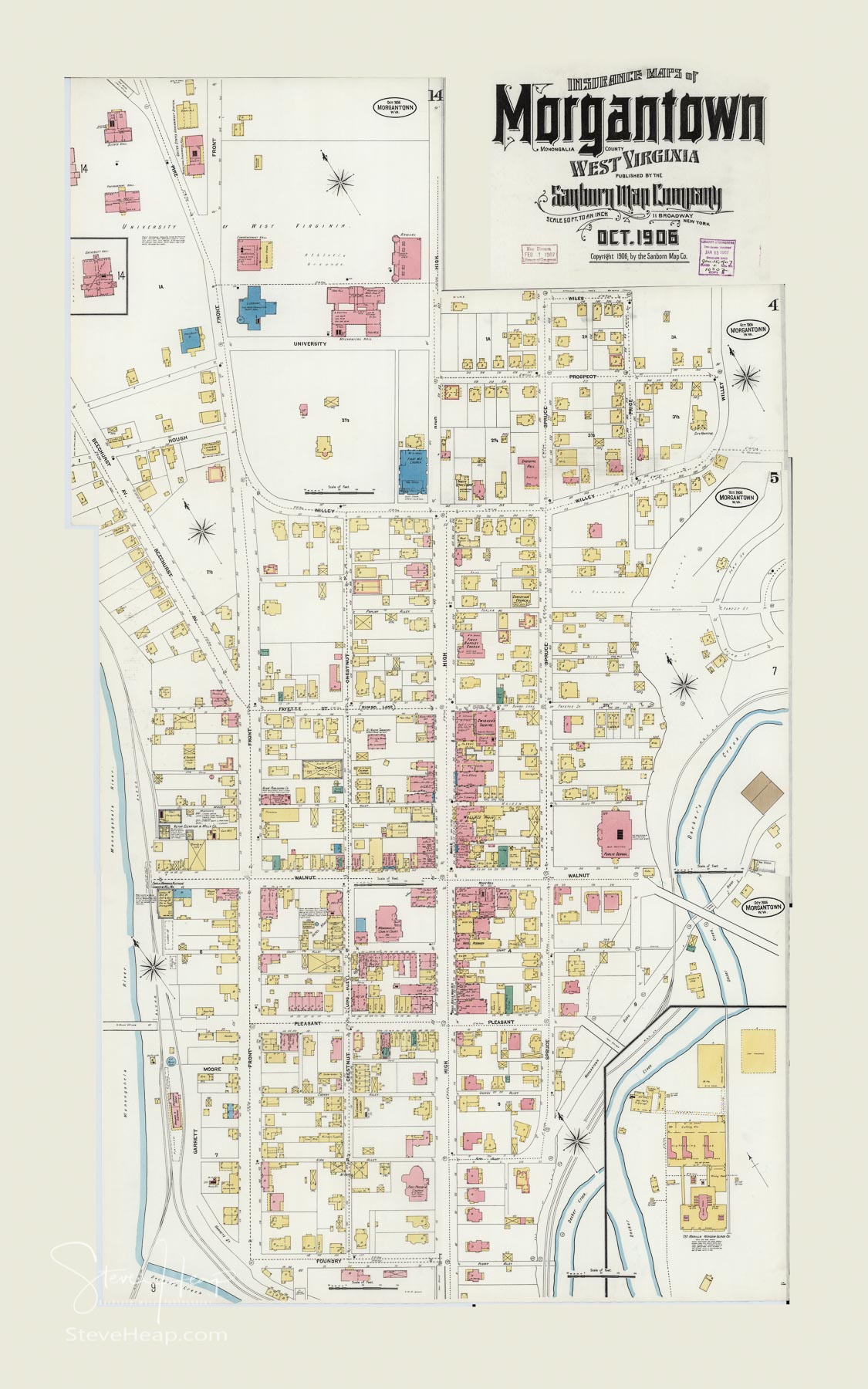
I also found a series of maps created by the Sanborn Company. They are called insurance maps and I think they were used to calculate the risk of fire damage by showing where fire hydrants were installed in the streets. Here are a couple of them:
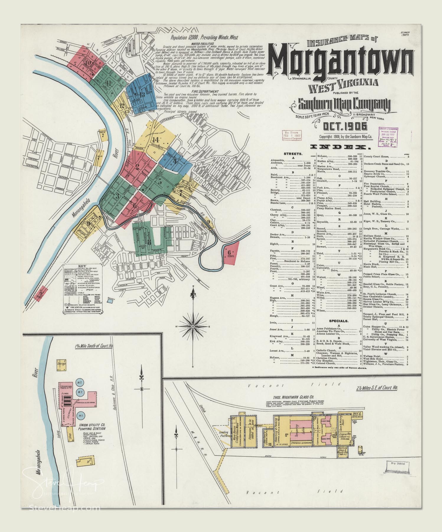
This second one was actually four separate maps and I stitched them all together to make one overall plan of the city as it existed in 1906:
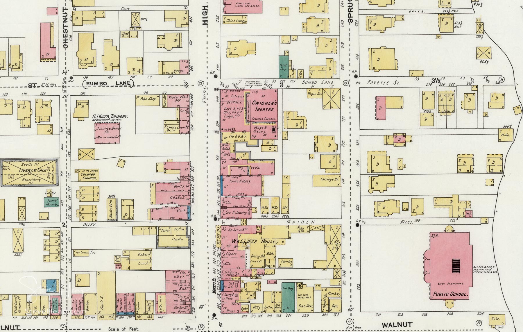
Again, the level of detail in the maps is extremely high. Here is a small section:
I believe there is one of those original town layout maps for Philippi in West Virginia – that needs to be my next project to find that one and enhance it!
Incidentally, I decided that my prices of prints from these maps from the Library of Congress were too high and so I have massively reduced them. No need for a special discount code – they are permanently at a lower price! You can find my collection of maps and old drawings here
And you can read the next story about these maps here.
